If you have been following Dauntless at Share.Delorme.com/Dauntless then you already know the outcome, since this blog is on a tape delay. That way there is no chance of a wardrobe malfunction.
Though I want to share some reflections of the last few days:
While it took three iterations of the Plan, the last plan was the best one and one can’t ask much more than that. The first day, having departed from Elsinore, (yes, Hamlet’s castle),
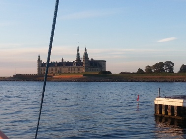
Elsinore Castle. Hamlet doesn’t live there anymore.
early in the morning, there was a favorable current for about three hours. Winds stayed light, for Dauntless that is less than 15 knots, for most of the day.
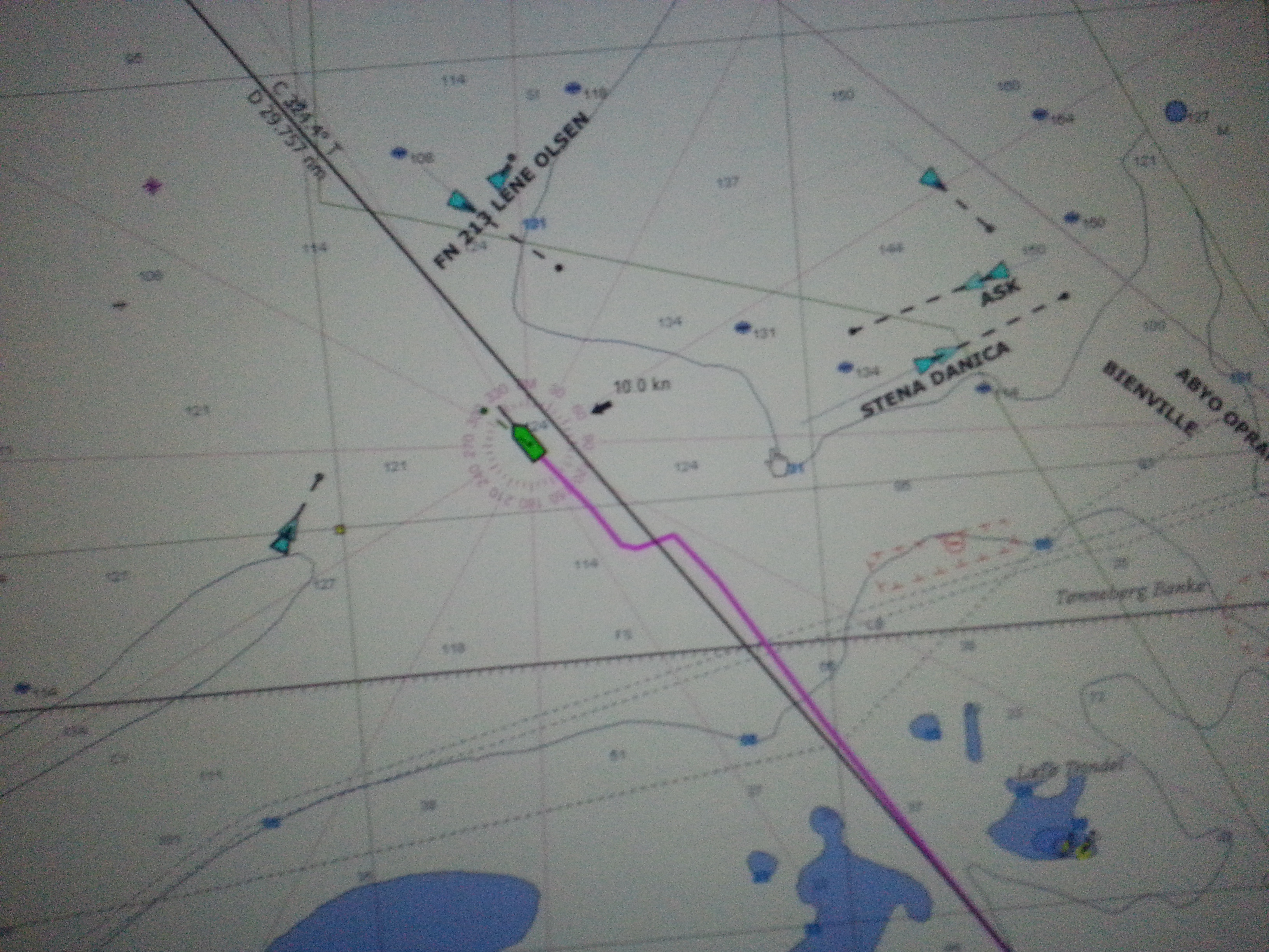
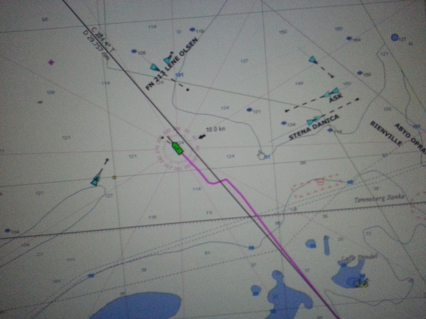
This was actually midnight, but I put the screen on “daylight” because i needed to make sure i understood the situation.
Once I got past the first choke point off Anholt Island, it was mid-afternoon, so I decided it was a good time for dinner. I grilled a mackerel I had bought in Denmark. It was really tasty. I realize that most mackerel I’ve had is not as tasty because it’s overcooked and not as fresh.
As the afternoon rolled on, being so close to the shipping lanes, I saw more ships than I had seen in the two days in the English Channel. They were converging at the obvious choke point: into the Kattegat, over the top of Denmark and into the Skagerrak.
And they made it into a four lane highway! The slower ships would be going 10 to 12 knots and they were being passed by ships doing 15 knots. And the ships were not more than a mile or two apart.
Then to add some spice, high speed ferries would be going perpendicular to this highway speeding by at 25 to 30 knots between Sweden and Denmark.
And of course dauntless plodding along at 6 knots had to stay out of everyone’s way.
By the time I passed over the top of the Jutland peninsula into the Skagerrak, I was exhausted.

The winds did pick up during the evening and into the night. I turned west over the Jutland peninsula at around 03:30 and then went another hour to the west to make sure I was out of the shipping lanes and somewhat protected from the winds. Anchoring was easy and I was finally in bed at 04:30.
I was so exhausted I did not go to sleep immediately, but probably did within 20 minutes, and then I awoke at 08:15, started the engine at 08:25 and had hauled the anchor and was underway at 08:32.
I must admit when I first awoke, I didn’t want to get up, I had only about 3 ½ hours’ sleep, but getting underway immediately made me feel pretty good, I knew I still had a long day ahead of me to Norway and I felt fine.
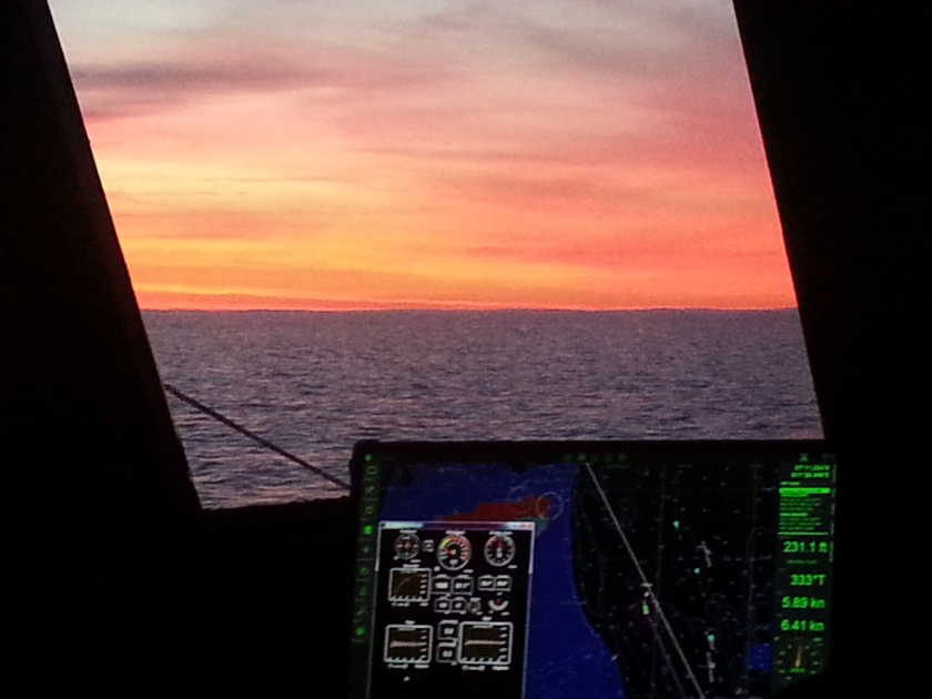
Clouds are cirrusstratus
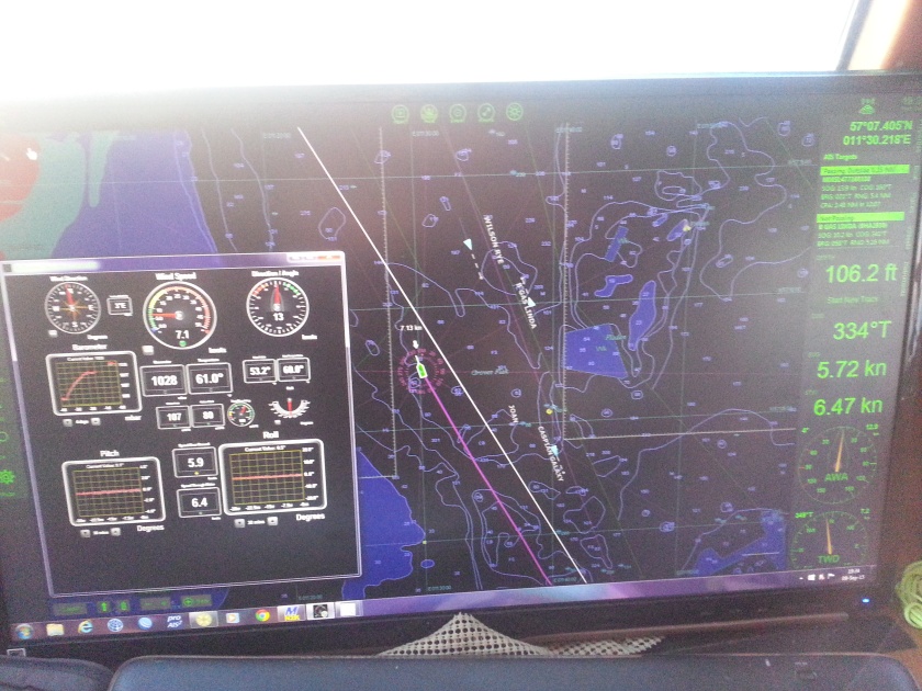
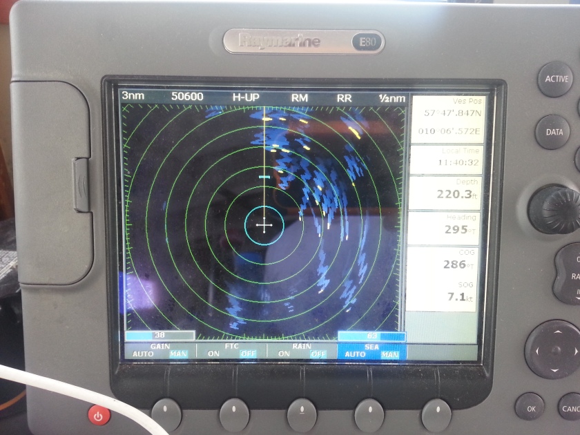
Now once getting underway, I see numerous marks on the charts designating wreaks,++, a lot of wreaks. Remember the Battle of Jutland was just west of here. So leaving the Jutland Peninsula to the south, I’m seeing more and more boats showing up on the AIS and radar.
More than 50! They are fishing boats, evidently they must know exactly where all the wreaks are so as to maximize their fishing/trawling, but not lose any gear.
Anyway it was an interesting sight and clearly I had to detour around them. But within minutes I hear a “securite” announcement on the VHF and basically it said a high speed ferry was coming thru so all those fishing boats better clear a path.
And they did, as I did. The ferry was going 25 knots, he even called a Maersk ship to confirm he would pass behind him on the port side, which he did with at least a half mile to spare. Not more!

Then a bit later, the Matz Maersk passed in front of me, maybe a mile and produced the biggest wake I have seen in a while, at least 6 feet. It caused breakers; I was impressed.

This ship produced a tremendous wake, more than 6 feet, with breaking waves!
After that that things started to quiet down because I was getting north of the shipping lanes.
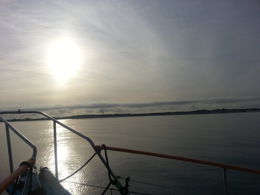
By late afternoon, I could see Norway.
A great sight at the end of a great day.
I anchored that night in the islands of Norway. The first place I had picked based on the chart, when I pulled into the cove, it was clearly too tight, so I backed out and went about ½ mile to the west and found a much better place. I was only 50 feet from the island to the east, the direction the wind was blowing from, but I had about a quarter of a mile downwind to the west and that’s what I wanted.
I went to sleep and slept for 10 hours.
Next day, I had two hours into Kristiansand and in spite of the strong winds, this dock had both cleats and bollards, so it was easy to throw a line over and I was tied up in minutes in 30 knots of wind.
220 nm and 52 hours after leaving Denmark, I was in Norway.
I Love It When a Plan Comes Together

Four short videos of my picking a spot to anchor:
- My initial choice: ErrorThis video doesn’t exist
2. That won’t work:
3. This one is just right:
4.. Where I did anchor:
Please excuse the quality, I was busy.