Seconds from Disaster

A long, harrowing day was over. A good night’s sleep erased much of the drama. I was closer and closer to the end of this Baja bash.

07:25 I get up

07:30 I did my morning checks and log entries:

  • Fuel: 3.25” port; 5.5” stbd
  • Batts: Current draw -8 amps, 12.48v, -84 amp-hrs.
  • H2O: 72-gal port, 82 gal stbd, feed stbd
  • Oil: right on the full line
  • ATF: 1 bar down, NC (Since I was still losing ATF, I checked this, normally I don’t)

07:53 Engine start, 6625.88 engine hours; Systems all Go.

07:58 Haul anchor

08:08 Anchor secured.

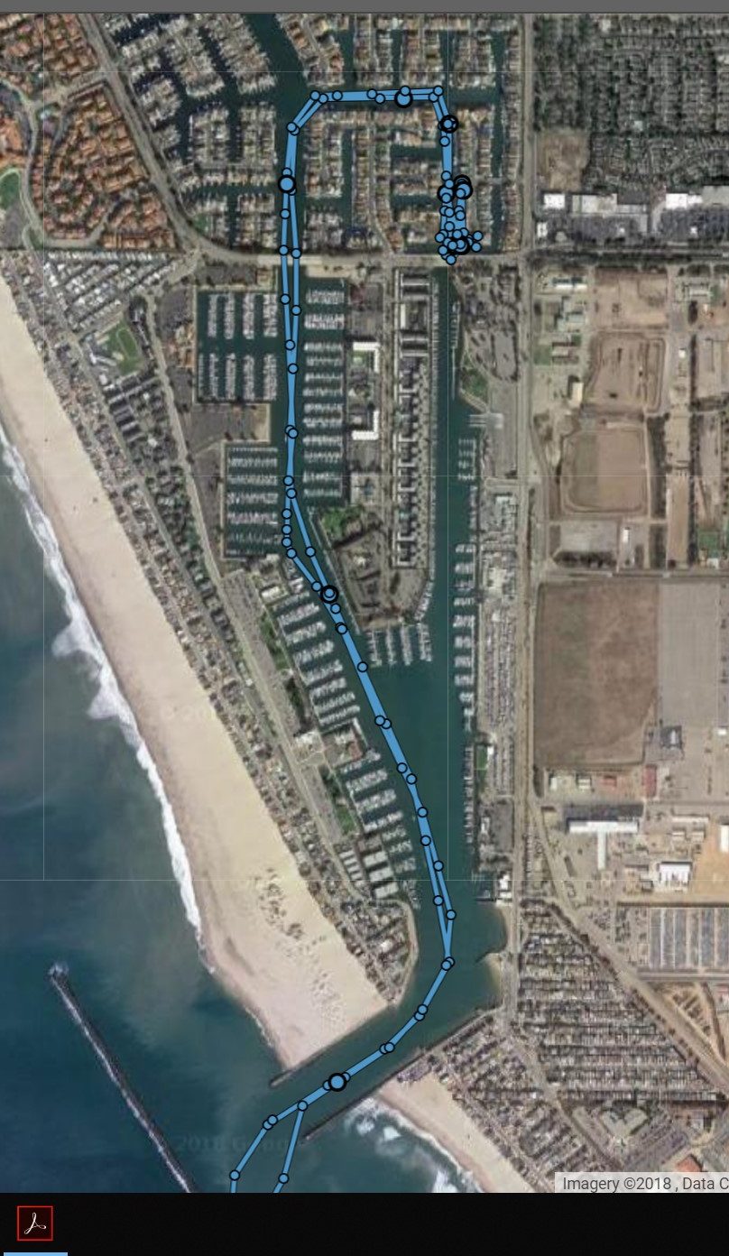
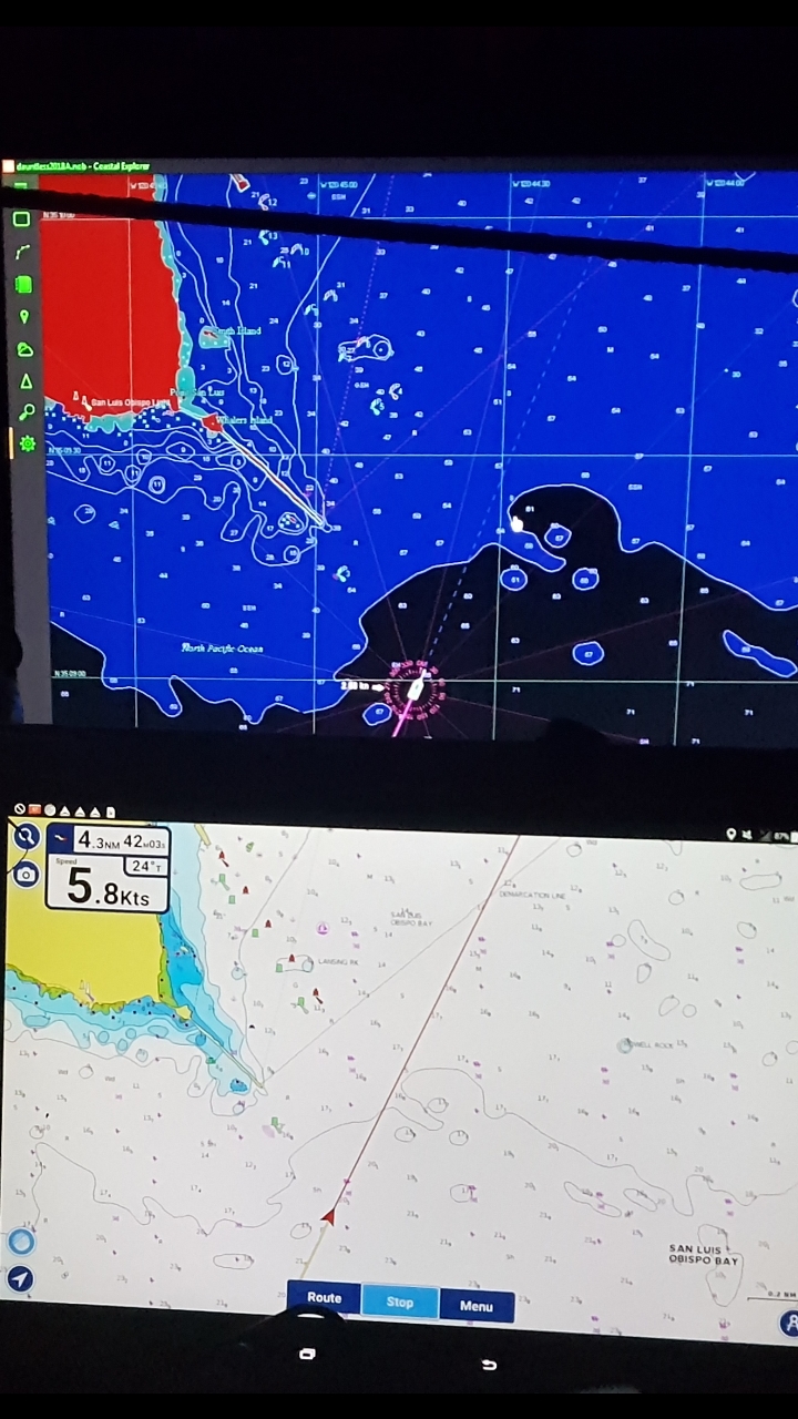
08:10 Underway to Morro Bay, following the track I came in on.

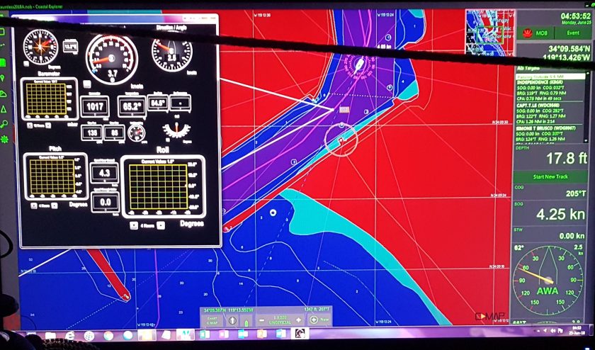
08:15 Do weather observation: Overcast Stratus Strata cu, Vis 2 miles fog, 1017mb 55° 51° 49° (sea temp) winds 27005

08:42 1700 rpms, 6.8 kts, slow to 1600, 6.4 kts, 1-2 ft swell on bow, larger swell 3-5 ft n bow. Pitch +4°/-4° Roll +6°/-3° benign.

09:25 1600, 6.5 kts, course 293°T, winds 27007 Pitch increased to +8/-8°

10:22 Change course to 016°, 1600 rpms, 6.2 kts, 3.5 nm to Morro Bay entrance. 7 knot winds on beam are producing a lazy roll of +10° (to stbd)/to -05° (to port).

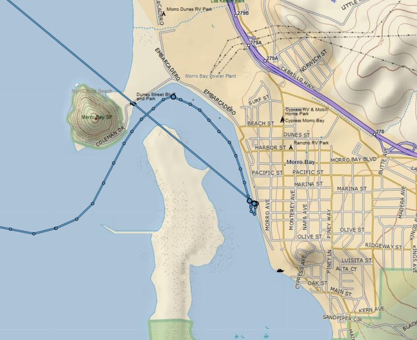
11:30 Enter Morro Bay. Spot my first Sea Otters. Great.  One more thing not to run over besides the ubiquitous paddle board and kayak people.

Sea Otters of Morro Bay

12:03 With a slow, almost idle, 4 kt approach (The minimum speed to have enough way to control boat), I approach the Morro Bay Yacht Club dock. It parallels the coast and there is ample room for me. I make a 180° to port (the direction this KK loves to turn) and am tied to the dock minutes later.

12:05 Docked at MBYC. An easy day, 3:55, 23 nm, 5.9 avg speed.

Arrival track is good. Departure is Garmin.
If you go to Share.Delorme. com/Dauntelss by clicking on the dot it gives you the speed, time and location, but times look converted. Thanks to Google, Garmin or Windows.

Morro Bay turned out to be a delight. Delightful people at the delightful Morro Bay Yacht Club (MBYC). If I was ever in one place long enough to join a yacht club, MBYC would be the kind of place I’d love to join.  Having to wait out the weather for four days turned out nice. Really reasonably priced at $35 per day, it was a pleasure to be there. I felt good and knew that time wise, I’d be good to go if I could leave on the 30th.

Morro Bay Yacht Club hamburger night
Dauntless in front of the MBYC

I watched the winds every day and the forecasts were tracking well. I thought to leave Friday, but the winds were still up and while forecast to go down later in the day, this is a perfect example of when I say, “Don’t leave based on a forecast”. If your waiting for light winds, wait until you see light winds.

Also, MBYC had hamburger night Friday evening or maybe it was cocktail hour. In any case, I vowed to leave early Saturday morning, if winds were light as predicted.

Now the plan was getting down to hours. The anticipated 36-hour weather window showed light winds becoming increasing strong, but from the south as Saturday progressed into Sunday, but by Sunday afternoon, the northerlies would be back with a vengeance, 30+ knots west of the Golden Gate.

Additionally, the trip up San Francisco Bay must be timed for the currents and tides. The currents are as strong as hell’s Gate in NYC. So, I had to back up all my arrivals and departures so that I would arrive at the Golden Gate between 12:00 and 13:00 Sunday July 1st.

To get there at that time, I had to leave Santa Cruz before 03:00. So, if I wanted 5 hours sleep in Santa Cruz and a time to have dinner with some new boat friends who had their boat there, I had to leave MBYC at 01:00 to do the 121-mile trip in 18 hours, getting me to Santa Cruz by 18+1= 19:00

No problem. Just an early evening and get up at 01:00.

this picture was taken just 5 hours before my departure. I was so enamored with the sunset that I really did not look at the situation.
Notice the solar panel array on the port side stern of the sail boat in front of me.

Dauntless was parallel parked between two sailboats. The evening before I had asked about leaving that early, anything I needed to know. Everything seemed routine. I should be able to just push the bow out as I realized the last lines.

Maybe the sailors giving me this advice did not realize that Dauntless was 44,000 pounds? Certainly no one warned me about the current.

01:15 up, Saturday morning dawned with the expected light winds, I was ready to go.

01:20 As I did my routine combined current check and pee, it was obvious that the current was not insignificant.

The next 8 minutes were the most harrowing of the last three months.

It was obvious I couldn’t just undo the lines and push her out away from the dock and SV 15’ in front. Plan A was dead.

The stupid sailboat in front of me has two solar panels out behind his stern. On the first picture of this post, the sunset, the solar panel array is visible on the port side stern of the sail boat in front of me. They are probably 12 to 15 feet from my bow pulpit, which is 5 feet above them. But my hull will impact them before it hits anything else. No fender could protect them. This guy should be on a mooring.

Plan B: I untied all lines, but for the midship cleat. I wrapped it around the dock cleat near the stern, so it would slide thru once I released tension on my side. Meaning the line was secured to the boats stbd midship cleat, then back to the stern cleat on the dock and then I’m holding the bitter end in my hand while on the dock, near the pilot house door. The boat is in neutral at idle. For this to work, my plan is to give the bow a mighty push from the dock, releasing the line while I clamber on board.

With one mighty heave, I was truly seconds from disaster.

Dauntless was not moving out as much as I had hoped. I also was keenly aware that I was risking her leaving without me.

I clambered on board, as dauntless drifted forward crab like, her bow maybe 15 feet from the dock, stern still near the dock. I debated momentarily, for a split second at most, whether to just give her a shot of power, hoping that she would go straight out into the channel.

At 1.5 knots, that about 2 feet per second. In the 6 seconds it took me from release of the line, get on board and into pilot house, Dauntless moved 12 to 15 feet, the bow pulpit was almost over the left side of the sailboat. The stupid solar panels are a few feet from my stbd hull.

It was clear to me in a moment that if I gave it forward power, it would rake the entire starboard side of Dauntless against the stern port quarter of the SV.

I quickly put her in reverse and slightly increased power to 1100. I also had a sailboat behind me. I ran out to the bow, just in time to find off the stupid solar panels as the Kadey Krogen finally started to retreat.

I ran to the side deck to see what kind of room I now had behind me. I need to be tied to the dock I bought myself some more seconds by leaving her at idle in reverse. This gave me enough time to get to the side deck and get a line on the dock cleat. I made it tight and thought about what to do.

I took some needed breaths. I had to be calm now What were my options? It’s almost 1:30 in the morning. No one is getting up soon. On one hand it’s only a schedule, but being alone, makes the schedule even more important. If I didn’t leave now, I would be forced to run overnight. Which then has an impact the following day.

The Golden Gate timing was immutable.

I wanted to leave, but the idea that I start me day be destroying this boat’s solar panels would really fuck up my day.

I tied the boat thru the stern cleat to the dock’s cleat just a couple feet away.

I would try to push the bow out with the stern tied. I wouldn’t do anything else. Engine at idle, transmission neutral.  It was just an experiment to see how far the bow would actually go out. If it went out to 45°, It would probably work.

It went to maybe 20°.

Tied again with a little more slack on the stern line, same results, but now she headed for those f…ing solar panels again like they were a magnet.

I had some seconds to spare this time, but I had to get her in reverse. We were still attached to the stern dock cleat. I had tied it so that while in reverse it did not have enough slack to hit the boat behind me. In other words, while I could watch the bow, I had to make sure when backing not to hit the boat just behind me.

Then I noticed an interesting phenomenon in reverse, attached to the stern cleat, the bow came out.!

That made perfect sense since Dauntless stern always wants to starboard. I need 2° of right rudder to go straight. In reverse, the prop walk is still to the right, to starboard, which is pone of the primary reasons, I always try to dock and tie on the starboard side.

(which in a recently found video has me backing into the slip in Golfito, Costa Rica. Once I figure out how to get it not inverted I will upload)

I checked the line on the dock and boat to make sure they were secure and then gave her more power in reverse. The bow keeps coming out more and more. This would work.

Back to idle, I quickly retied the stern line so that the closed loop was over the forward horn of the cleat. I then ran the line thru the stern hawse pipe forward inside the boat to the midships cleat.

I put the boat in reverse and added some power.

The bow came out further and further. Still in reverse, I sent down to the midships cleat, and took the line in my hand and walked it back to the pilot house door. With the line in my hand, I checked the port side to make sure it was still clear, gave her more power and the bow came well out.

Now, I knew the terrible downside of this plan. If that dock line snagged on something, at best it would slam the boat back to the dock hitting the boat ahead, at worse, I could drip the whole dock up, causing even more mayhem.

And I couldn’t check it. I still had to get the stern out to not hit the sailboat.

When it seemed, the bow would come out no more, I had to force myself to be slow and put her in idle, neutral, forward, power. Probably two to three seconds.

But remember at 2 feet per second forward due to current. In just doing that, reverse to forward, without slamming the damper plate, used half the distance between the two boats.

I stayed right behind the helm. I had to hope the line slipped off cleanly. As the solar panels were about two feet off the pilot house door, I swung the wheel hard right and goosed the power, to kick the stern out. The boat was still crabbing forward, so even with that maneuver, the stern only cleared by a few feet.

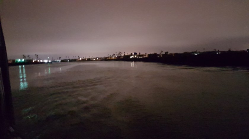
But she cleared. I hauled in the stern line quickly and turned on my driving lights to make sure I didn’t run over any sleeping sea otters.

01:28 Underway to Santa Cruz. I thanked every god I knew.

In hindsight, some thoughts:

  • It’s a no-brainer that I should have just swapped positions with one of the two sailboats. Either being in the front or end, would have been leaving no problem. Also, everyone at the YC was so accommodating, it would have been no problem.
  • Not as obvious is how the lack of a functional bow thruster affected this. It’s been three plus years now since by bow thruster stopped working. At least two times, we thought it was fixed, only to discover it wasn’t. But clearly, it hasn’t been a priority. Why?
    • Before it stopped working, there were two memorable times when I needed it, but winds and currents overwhelmed it. Thus, it has seemed better to just learn to live without than to depend on something that may not work as well as hoped in the worst conditions.
    • Be cause of that, I also stopped doing stuff because some marina or dock master suggested it. Now, I’ll say, “I don’t have a bow thruster, I can’t do that” Oh, no problem, we’ll put you on this “T” then! Duh!
    • And now this experience reinforces my feelings that at least for me, I’m better off without it. My first thought was if the bow thruster was working this would have been easy. And therein lies the problem. I would have pushed the bow out, jumped on board, used the bow thruster without the understanding that the boat was moving 2 feet a second and while the bow would have missed, the broad side of the boat would have slammed into the stern of the sailboat. No way was it going to get out of the way in the 10 seconds I had.
  • Yes, God certainly Watches Over Fools and Drunkards.


The Rest of the Story

Larry had returned to Alaska also, so when I got back to Dauntless on the 24th. I’d be taking her the last 400 miles of this 2000+ mile trip to Vallejo on my own. I had a plane ticket to leave Sacramento on 3 July to Austin.

My route thru Channel Isl Harbor

Assuming I had to arrive on the 2nd, I had 8 days to get to Vallejo. Ray, one of my boat mates in the new marina had kindly offered to give me a ride to the airport at 0h dark-30, so, I was back on the clock.

The first leg was critical, 70 nm to Point Conception. Winds had been light or southerly for two days, while I was in Salt Lake City, now, my day of departure, Monday they were forecast to increase from the west as the day progressed. (This is the way I use weather forecasts, looking at the trend, but not necessarily believing the specifics). 70 miles is 12 hours steaming time. I wanted to get around Point Conception before 16:00, otherwise as winds picked up on the bow, we would go slower and slower and I would become ever more miserable, yet again.

Therefore, I planned my departure from Kyoko’s dock at 04:00.

I never sleep well before embarking on any kind of trip, be it, by plane, train, automobile or boat. Thus, I was up just after 3 and figured I may as well get this show on the road.

I have a standard departure procedure. One that I adhere to since pulling away from the dock in the Chesapeake, 4 years ago, only to have the engine stop two minutes later from no fuel. At that time, I dropped the anchor in emergency mode (pulling the chain out of the wildcat and letting the anchor freefall) to stop our drift into nearby boats. Once that was done, I headed to the engine room to see what happened. A quick glance showed both fuel tank feeds were closed. Since I had just opened one, it was clear to me that in my mindset to “open” a closed valve, I had closed the one that was open. So much for check lists.

Getting Underway at 04:07

Way back then, I still did not have my auxiliary fuel pump installed, so of course it took 10 minutes of lift pump masturbation to get the air out and everyone happy again.

Consequently, I follow a standard start up routine, which consists of:

  • Engine room check, smelling and looking for obvious leaks and confirming fuel feed and Racor use.
  • Engine start
  • Turn on breakers for:
    • Running lights
    • VHF radio
    • Radar
    • Auto Pilot
    • “Loran” that’s the breaker used for my USB ports now
    • Horn
    • Check Anchor light is off
  • The boat computer, modems, router, Maretron system, two Samsung LCD displays are all 12 volt and on a separate breaker that is not on the pilot house system. They were already on, as that system takes a few minutes to boot up, as the router can be picky.

Now, on this night, I had already taken one spring line off before I went to sleep. In hindsight, that was probably a mistake, as it got me out of my routine.

Channel Isl Hbr overhead docking

03:30 I did my engine room check. I was also out of my routine because my engine room bilge pump was off and had been for the 10 days I was on this dock. With the little leak I had from the transmission, while no significant oil would be discharged, it would still make an embarrassing oil sheen, would not be nice for Kyoko and Mike, who had so graciously given me this spot. I could easily wait until we were off-shore.

03:43 Engine start. To this day, it is unclear to me what I was thinking. But I didn’t turn on the Auto Pilot or the Radar. More likely I did, but in any case, I untied from the dock, without realizing that neither was on.

03:52 Free from the dock and underway. I make the 90° turn to starboard to clear the dock, at which point I realize the Radar is not on. It’s dark. I don’t travel without the radar in the daytime, let alone now. But what to do.

These fairways were relatively wide, maybe 150 feet, but with boats and/or docks on either side. To return to Kyoko’s dock, I would have to do a 180° to port, then a 270° to dock bow facing out, as I was. In the dark, alone, that did not appeal to me. I also did not want to dock bow in, tie on the port side, as all my lines were on the stbd side. Again, being alone, limited my options. I decided to press on and look for a convenient place to stop to be bel to diagnose and solve the electrical issue.

In hindsight, I should have turned around and docked bow in. As it turned out, where I did decide to dock had a current that was vexing. At least this was a dock I knew. But at the time, I was more concerned about hitting something and felt it would be better someplace else. There must be some fuel dock or some such on the 40 minute it would take to go thru the channels and harbor to the sea.

My abrupt stop of video and boat for that matter is because while approaching the bridge, I was sure it was the same bridge I had come under two weeks earlier. But then, it that moment of panic, I thought maybe in the dark, I had made a wrong turn. I didn’t, but that’s what being in the dark will do for you. 

Error
This video doesn’t exist

So, I slowed to inch under the bridge. I then proceeded to spend 15 minutes trying to back in a dock. With no current, it would have been easy, but in this case, there was a current, pushing the boat and especially the bow to port, so as I backed I’d end up almost perpendicular to the dock. After 3 or 4 attempts, I gave up and decided it would be easier to just go bow in around the corner. It was, and I did.

Coastal Explorer and Maretron data laving CI hbr

Just tied to midships. The boat secure, I was able to get under the helm to see why I had no power to the radar and autopilot.

Pilot house voltage has been an issue since day 1. I need to run a bigger or additional line and ground to the pilot house. When on long cruises, once the batteries are fully charged, the voltage at the batteries goes to 12.85v or thereabouts. The problem is that voltage in the pilot house is down to the low 12v. The Raymarine radar display will blink out momentarily when the voltage dips below 12. This usually happens when the auto pilot commands a longer turn. It gets annoying. So, since I never got around to running the additional wires, I instead did my normal half-assed fix of jumping from one buss to the other. The pilot house electrical panel has three separate busses. It used to be two, but sometime a couple years ago, I thought I had a fix for the radar by making a third buss. It sort of worked.

But coming north with Larry the radar display (not the transmitter or computer, only the display) started blinking again. I added another jumper. Worked great. But then upon arrival, I redid in a different way. Why? who knows!!

That different way is what was not working. I realized right away why the autopilot wasn’t getting power. So, I put it back the way it was, and all was good. That took 5 minutes. The additional docking took 45 minutes.

That delay would bite me in the ass later that afternoon.  Once I got out to sea, the winds were light from the south or southwest. I was headed 280°, just north of west. Winds out of the south were good, east better. Late in the morning the winds started to turn to 280° at 06 kts, right on the nose. 3 hours later at 14:00 they were 28012 g 15 kts, pitching had increased to 12° up and down and speed was reduced by one knot.

Underway again
Error
This video doesn’t exist

I was able to make the turn to the NNW, 340° at 16:00. Winds had already increased to 290° 14 g 20. The turn took the winds and seas off the bow to the port forward quarter, much better than dead ahead. I was grateful for my early morning start.

The rest of the day was a piece of cake. Winds stayed 300° 15 g 20 for the rest of the evening. We were pitching and rolling, but it was tolerable. I didn’t jump overboard as I have been tempted to do when going into ahead sea.

And now you know the rest of the story.

Passing an Oil Platform south of Santa Barbara

I arrived in off Avila Beach in San Luis Obispo Bay around 22:00 and anchored that night using the radar. But then you already knew that.

Anchoring at Night


Time Waits for No One

I was on schedule, the one I’d made month’s earlier. It was June 10th.

So Calif from SD to Channel Islands The missing segment north of San Diego to Oceanside, is simply Garmim, being Garmin.

460 nm to go to our winter home of Vallejo, close compared to only a month ago, but now time was getting compressed. My hard, drop dead dates were also much closer.  July 6th was the hardest one, my flight from Austin Texas back to SGN, Saigon, HCMC, Vietnam.

Airline tickets can always be changed, but at a price and I was tired of just pissing money away.

CE chart off CA coast to Channel Islands Please don’t get confused. Channel Islands Harbor is NOT in the Channel Islands. But instead is just south of Oxnard on the mainland. That’s California just being California.

I also had a wedding in Salt Lake City June 23rd, that I really, really wanted to attend. Three years earlier, I’d crossed the stormy North Sea to get back to Ireland in time to meet my dear friend Jennifer, who was coming to Ireland just to see Dauntless. I’d known her since she was 8 years old. Now, she had met the love of her life and was getting married. I had to be there.

I also wanted, needed to go to Fairbanks, Alaska before I left the USA

I’d already arranged the marina for the winter, in Vallejo California.

It was simply going to be a busy month, but doable if the weather cooperated.

Entering Channel Islands harbor, which is NOT in the Channel Islands. But instead is just south of Oxnard on the mainland. That’s California just being California.

The most recent version of the plan had Dauntless and I getting to Vallejo by the 17th, flying to SLC on the 21st, then onto Fairbanks on the 25th, ending in Austin, Texas on the 3rd. I have good friends there and it so happens that the plane ticket to Vietnam is significantly cheaper if it starts in Austin (or other smaller markets) then NY or Detroit, even though my routing goes thru Detroit.

What are friends and family for? Friends and family are there to talk you out of stupid ideas or better said: to help you see the better plan.

Kyoko’s beautiful house in Channel Islands harbor

My friends, Mike and Adrianna, who now also have a Kadey Krogen 42, called While Knuckles, had suggested earlier that I stay in southern California longer. The reason I had resisted was that that plan upset my sense of completion: let’s get Dauntless settled, then travel.

The Pacific off the Southern California coast, south of Santa Barbara, has significantly better cruising weather. The winds are still predominately from the NW, but more like 50% of the time versus 90% further south. In addition, there are long periods of light & variable winds. Perfect cruising weather.

Dauntless from Kyoko’s house

And that’s what we had for the next five days.

Mike and Adrianna keep their boat in front of a friend house in Channel Islands harbor. They spoke to their friend, Kyoto, and she was happy to have my Kadey Krogen there, while White Knuckles was in Ensenada having some extensive upgrades taken care of.

The weather was also changing. It became clear that I would have to wait to do the last 270 miles from Point Conception to the Golden Gate and Vallejo. So, I took

Dauntless in front of Kyoko’s house

Mike and Kyoko up on their offer to keep Dauntless there as long as I needed, while I:

  1. Waited for weather
  2. Attended the wedding and
  3. Flew to Fairbanks and back
  4. Spent more money on tools and spares at Harbor Freight

I had to change one place ticket, but this was a much better plan. I was able to travel to the wedding and then Alaska knowing Dauntless was in good hands with sharp eyes watching out for her. I really appreciated the hospitality and it made for great 10 days

.

Error
This video doesn’t exist

Harbor Freight is Wonderful

,

Anchoring at Night in Strange Places; It’s not for the Faint Hearted.

Only day’s away from completing this 2,000-mile, two-month journey, I found myself breaking yet another of my hard and fast rules I made for myself 5 years ago.  Entering yet another harbor at night, and having to anchor by radar, avoiding darkened, moored boats and mooring balls.

But like most hard and fast rules, I had to weigh the circumstances against various risks. In this case, anchoring at night was the least risky option. I’d left Channel Island Harbor at 04:00 for the 120 nm voyage to San Luis Obispo harbor. I’d planned on 19 hours. Thus, to arrive before sunset, would require me to leave the Channel Islands at midnight.

Leaving anyplace at midnight means a total disruption of my sleep cycle. I’d be starting a long trip tired and already behind my personal power curve. By leaving at 04:00, I’d be able to get a reasonable 6 hours sleep and 03:00 is on my natural wake up curve (though normally, I’d go back to sleep for another 3 hours).

Raymarine E-80 Radar, C-Map on Coastal Explorer, Navionics chart on Samsung Tablet


Therefore, anchoring in a strange harbor at night seemed for me to be the lessor of two evils.

Let’s talk some basics. Four years ago, I hated my Raymarine E-80 Radar. I felt (and still do) that it was 1980’s technology, dressed to look like the 21st century. It was on my lest to replace at the earliest opportunity when money allowed. I had wanted a radar that I could integrate into my Coastal Explorer and C-Map chart plotter, navigation program.

San Luis Obispo harbor

Using the “Auto” settings, the E-80 will show you if the Exxon Valdez is bearing down on you, but otherwise, it either filters too much or not enough to be useful for close in maneuvering. As the miles and time increased under my belt, I learned how to best fine tune the radar using the manual settings for gain and sea state (which is basically a filter) to make it an effective tool.

Whenever I start the engine, I also turn on the: radar, navigation lights, auto pilot, VHF radios and horn.

Always.

For the first lesson in using the radar is that you must use it when the visibility is ideal, to be able to effectively and safely use it when the visibility is impaired, whether due to darkness or weather conditions (mainly fog, rain is another issue).

While underway I’m constantly checking and identifying any radar contacts visually, as well as on the navigation charts (for navigation markers, buoys, etc.).

As soon as I spot something the radar does not see, I adjust the radar, fine tuning so to speak. Normally this is just a matter of adjusting the sea state setting, though sometimes I also must fine tune the gain. E.g. I may see a fishing skiff a half mile off my starboard quarter, but it’s not showing up on the radar. I’ll have to lower the sea state setting, maybe only a few points, until the skiff shows up, but not the countless wave tops around it.  Sometimes, I’ll have to adjust the gain also.

My goal is always for the radar to show me potential hazards, without showing me wave tops. For the last couple of years, my tuning technique has been good enough to do exactly that. Forget the “auto” settings, they are hopeless.

Since I don’t get many false alarms, this also allows me to maximize the use of the two zone monitors.  For coastal cruising, like I’ve done since entering the Pacific Ocean, I set up a ring at ½ mile, that’s an 1/8 of a mile thick. Thus, if anything enters that ring you get an alarm. If you just put a circle around your boat at ½ mile, the radar will see some clutter very close to the boat and thus render the alarm, ineffective at best and annoying at worse. I make this ring go about 220° to 300° around the boat. That way it will see something approaching from the stern quarters, but not directly behind, as the radar will occasionally see a reflection of the mast, again making it ineffectual.

The second zone I set up 1 to 1.5 miles from the boat, in a much more 20° arc.

On the open ocean, well away from land, I’ll basically double these distances.

If I do get any false alarms, I adjust again. Usually it happens as the sea state gets worse (bigger seas).

For my set up, I find values of both the gain and the sea state in the 70’s to work best. In flat seas, I can lower the sea state to just above 50, but again, even changes of 1 or 2 can make a significant difference.

On this night, entering San Luis Obispo (SLO), as the seas calmed as I entered the bay that is protected from the NW through the East, I readjusted the sea state, lowering the filter values. From my charts I knew there was a mooring field, presumably with some moored boats. I adjusted the E-80 so that it would pick up objects as small as the mooring balls. Had the seas been above 2 to 3 feet, this would have been an impossibility, but if I had such seas in the harbor, I wouldn’t be stopping in any case.

This night, with strong NW winds, the harbor was well sheltered and the seas where maybe half a foot or less. Under those conditions the radar will do well.

I open and secure both pilot house doors, so that I can have quick access to looking out. I also go to the bow to scan the approach with binoculars (7×35), which I find very effective a night in poor light conditions.

Thus, I have that visual picture in my head, while checking the radar to ensure it’s seeing the same things.  Again, because I am constantly doing this in the daytime in good visibility, I have the confidence to know what the radar is telling me at night, when I must trust

Here is a short video of  it of me getting ready to enter the harbor:

Error
This video doesn’t exist

Here are some stills made 2 minutes before the above video:

The radar 2 min before I took video
Coastal Explorer using C-Maps above, Navionics on tablet below

Three years ago, going through the main shipping channels of the Kattegat to the Skagerrak over the top of Denmark, I was terrified by what my brain perceived as the massive ship about to crush Dauntless. I was outside the channel, marked m red buoy, I knew the ship had to stay in the channel. The radar told me the buoy and this massive ship were ¼ mile distant, but my brain, every time I looked at the ship, I could swear was less than 50 feet away.

My mind was so convinced this ship was towering over us, that even as I checked and rechecked the positions of the markers on the chart and the ship and marker on the radar, all showed the target as more than a quarter mile away, but my mind would just not accept it.

I only calmed down when the ship was past.  In the daytime, my mind would not have been fooled, but at night, the perspective of distance, becomes very difficult.

I realized then that if I was going to continue to travel at night and not die of a heart attack, I had to make sure I knew exactly what the radar was telling and what it wasn’t and once done, accept what it showed.

So, this night, almost midnight, as I pulled into SLO bay, the radar guided me to a large area with a diameter of about half a mile with no mooring balls, though there were a couple of boats anchored on the west edge.

No fuss; no muss,

I was anchored in 25 feet of water at 23:20 having done 120 nm in 19 hours and 30 minutes, at an average speed of 6.2 knots.

The trip from CI Hbr to SLO. The Maretron data for pitching and rolling shows I did a fair amount after I rounded the corner to head north.

The morning after:

Error
This video doesn’t exist


Costa Rica Days 5 thru 7 – Isla Cedros & Jesusita to Bahia Guacamaya

I stayed two nights in the wonderful, quiet, still anchorage of Cedros & Jesusita.  It gave me time to catch up on my

Sunset in Bahia Guacamaya on 23 July

sleep and to complete the chores, cleaning and re-organization I should have done before I left the dock in Golfito.

Not the first time I have managed to stress myself by not finishing things as I should in a timely manner.

Won’t be the last, but still …

I hated leaving but it was time to move on.  I carefully followed by previous track out into open water.  If I didn’t take any shortcuts in; I certainly don’t take them on the way out.

I was underway before 8:00, as I had contrary current to contend with, I kept the rpms a little higher, 1700 today than the usual 1500 to 1600.  This gives me about an extra half knot, but also consumes an extra quarter gallon per hour or 17% more fuel.

Entering Bahia Samada at night of 22 July
Approaching Bahia Guacamaya


I was headed to Bahia Samada.  While it got good reviews on Active Captain, I’m starting to think all these reviews are written at a different time of year, with no south to west swell, because again it turned out to be rolly.

Also, buggy.  I’ve gotten in the habit like most experienced “cruisers” to turn on generator as the sun sets. It’s at this point that the winds will decrease or die and the bugs come out.  Also gives me an opportunity to put a little charge in the batteries, while running the A/C to cool and dehumidify the boat.

I usually run it a couple of hours, though I am conscious of the noise and it there are any other boats nearby, I turn it off sooner rather than later.

As I turned NE around the cape towards Samada, there was a large area of rain showers and thunderstorms, seemingly right over my intended destination. Though my timing worked out well in that the storms were moving slowly west, so while it rained for a while, by the time I got to the anchorage for the night, it at stopped.

As I said, not a great place to stop.  Rolly and buggy (mostly gnats).  Therefore, at the crack of dawn the next day, I was ready to get out of Dodge.

Hauled anchor at 06:00 and was underway to Bahia Guacamaya.  This place also got great reviews and for once it deserved them.  Hardly any roll, quiet, beautiful.

I stayed here two days.  I got the water maker running again, cleaned up the stern deck and jury rigged my garden hose reel that I use for the stern anchor line.  I did a good job, only wondering why I had not done it weeks earlier. Another unknown mystery of the universe.

But even before that.  The trip was very nice.  When I had left the winds were light from the northeast, forecast to turn southwesterly during the day at about 8 to 10 knots.  As I rounded Cape Velas the winds were ESE at 20 knots gusting to 25.  That pretty much was the rest of the afternoon.  Very luckily, I was only a few miles off shore so the wind had very little fetch (the distance winds blow unencumbered over water) this kept the wave heights down, in fact they were less than 2 feet.

Dauntless was rolling on marginally.   Now had I come here a few hours later, the seas would have been much greater.  Just like the day I left Golfito, with the winds having blown all night, the seas were moderate by the time I left.

Also, I was able to check the latest forecast.  I use WIndyty.com for the most part as I love how they present the data and the options you have to change what you look at.  I pretty much only look at winds, though I may check the different weather forecast numerical models to see any significant differences. What was interesting about today was the forecast was very wrong, at least in terms of wind speed and for a small boat like Dauntless, that does make a significant difference.

I usually tell people, whether they ask or not, that weather forecasts are usually right, but when wrong they are usually wrong or time or location.  What do I mean?

The forecast was for 8 to 10 knot winds out of the east.  But 100 miles further north, the winds were forecast to be 20 knots.  So, in this case the forecast was wrong by location.  The timing was good.

Now since my Krogen on can go about 60 miles in 12 hours; 100 miles off on location makes all the difference in the world.  But if I was in an airplane covering a much larger distance, the location being off becomes much less of an issue.  Same thing if I’m a ship going 18 knots.

Now had I gotten up that morning with the winds blowing hard, I would not have left.  Because the other aspect of bad weather forecasts is that they usually don’t get better.  Meaning, if the forecast starts off incorrect, for any given time and place, it’s not like the weather will catch up.  Sure, it may look like the forecast is spot on 12 hours later, but more likely, it’s just a matter of chance.

So, I got to Bahia Guacamaya and just as advertised the bluffs to the east blacked the winds from getting into the bay.  Ver nice.  One of the best anchorages yet, certainly the best if I include the scenery.  So good in fact, I really regretted not have Trinh with me.  This would have been such a wonderful spot to explore together.

Here are some videos of the two days:

21 July 18:15, Entering Bahia Samada at night.  

Error
This video doesn’t exist

22 July Bahia Samada the following morning

Error
This video doesn’t exist

22 July 11:13 Underway to Bahia Guacamaya

Error
This video doesn’t exist

23 July Morning in Bahia Guacamaya

Error
This video doesn’t exist


Costa Rica Day 5 Summary: Engine Start 07:46, stop 18:50; uw 10 hrs 49 min, 67.7 nm, avg speed 6.3 kt. Average Roll while underway, +8° to -10°, delta of 18°;

Anchored Bahia Samada in 17 feet water with 100’ of chain out.

Costa Rica Day 6 & 7 Summary: Engine Start 06:00, stop 14:40; uw 8 hrs 30 min, 55.6 nm, avg speed 6.56 kt. Average Roll while underway, <5°either way, delta of 10°;

Anchored Bahia Guacamaya in 21 feet water with 80’ of chain out.